Demo
Loading demo…
Motivation
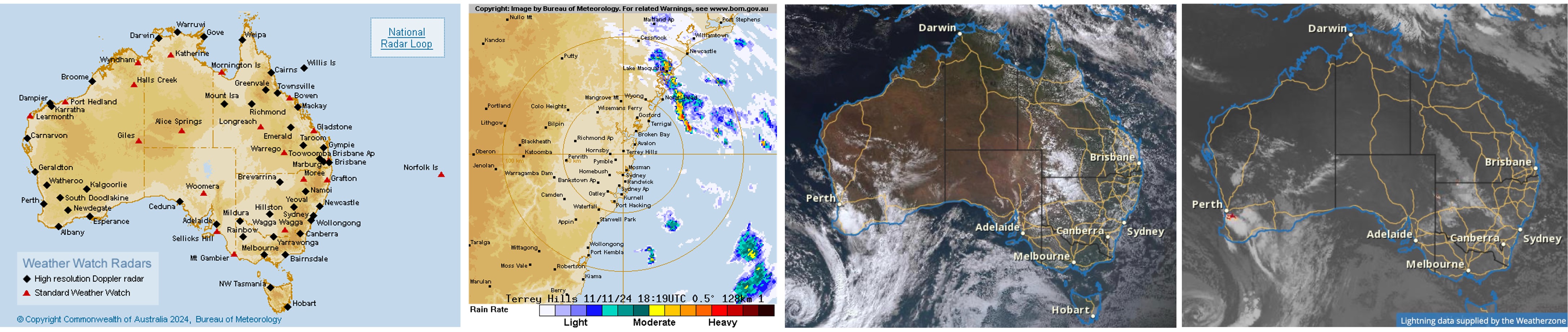
Weather radar observations are critical for severe weather monitoring and nowcasting, yet their spatial coverage is limited, particularly across remote regions of Australia. This motivates the development of machine learning-based methods that can transform wide-coverage satellite observations into radar-like reflectivity imagery.
Abstract
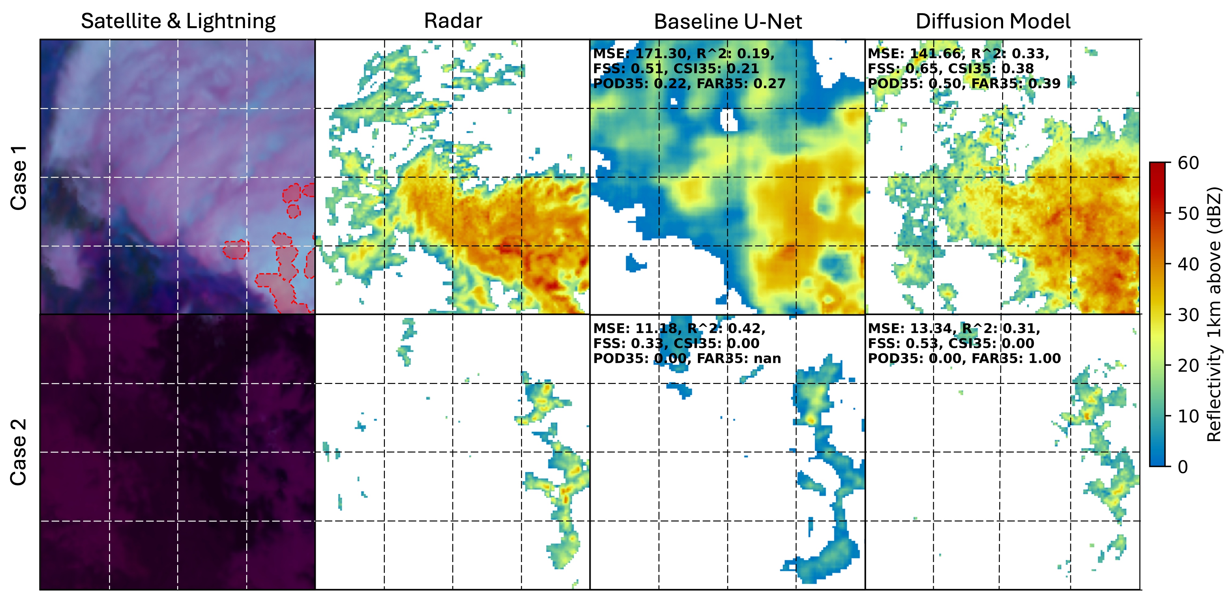
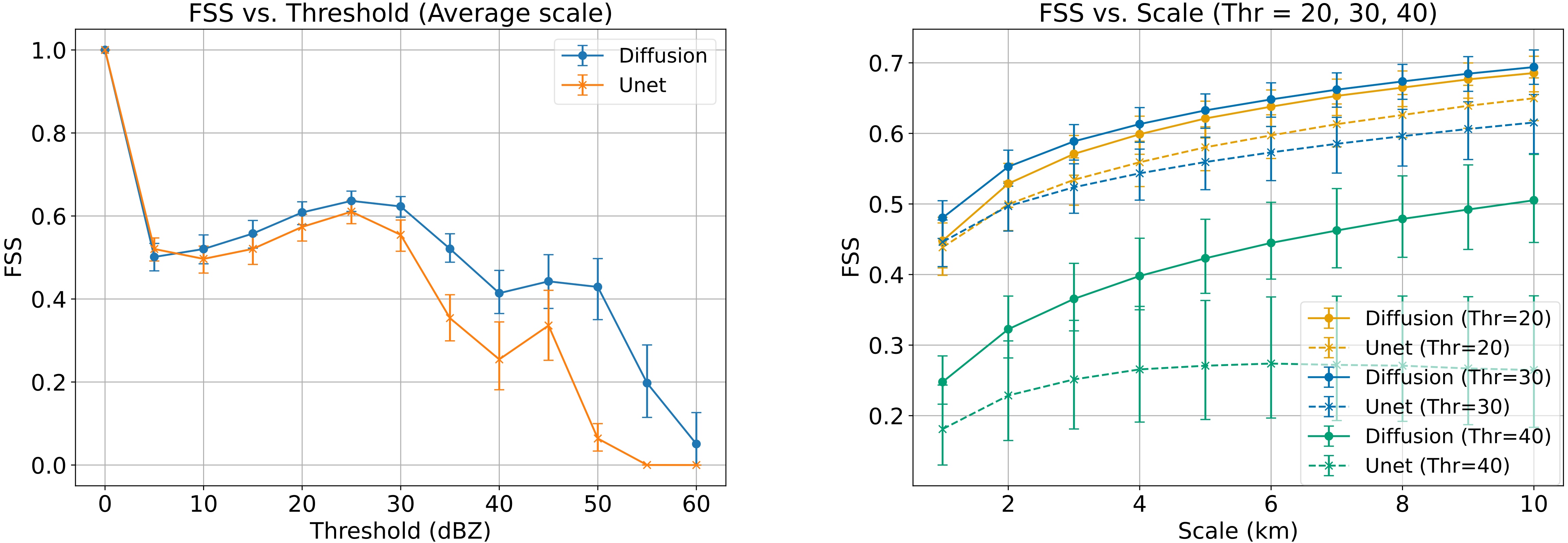
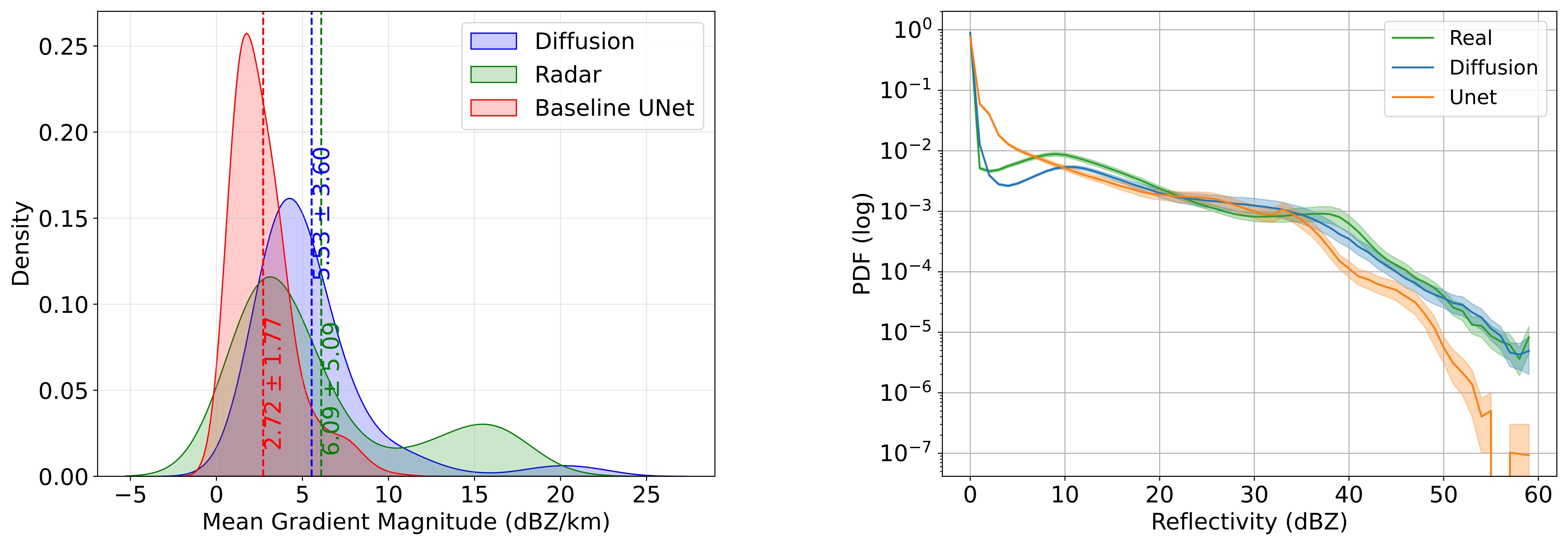
The limited coverage of radar sites has given rise to a demand for transforming the extensive coverage of weather satellite observations into high-resolution and accurate synthetic radar reflectivity imagery. In this study, we introduce a new method that utilizes generative diffusion models to address this challenge. Starting from pure noise, our diffusion model takes infrared images from the Himawari geostationary weather satellite and lightning observations from a ground-based network as inputs to control the generation process. The model’s iterative diffusion and denoising process helps capture the intrinsic uncertainty of satellite-to-radar transformation by generating probabilistic results, whereas nongenerative methods can only produce deterministic outputs. Our new technique improves the granularity and spatial accuracy of synthetic radar reflectivity imagery compared to previously published nongenerative U-Net models. In our experiments, the new technique enhances the emulation of severe weather by capturing finer visual structures in areas with strong radar echoes. Results show that images generated by our model outperform traditional U-Net models on key metrics such as the fractions skill score (FSS) across multiple thresholds, with the average FSS increasing from 0.40 to 0.50, and also produce a much improved statistical distribution of reflectivity, especially at the low and high ends of the distribution.
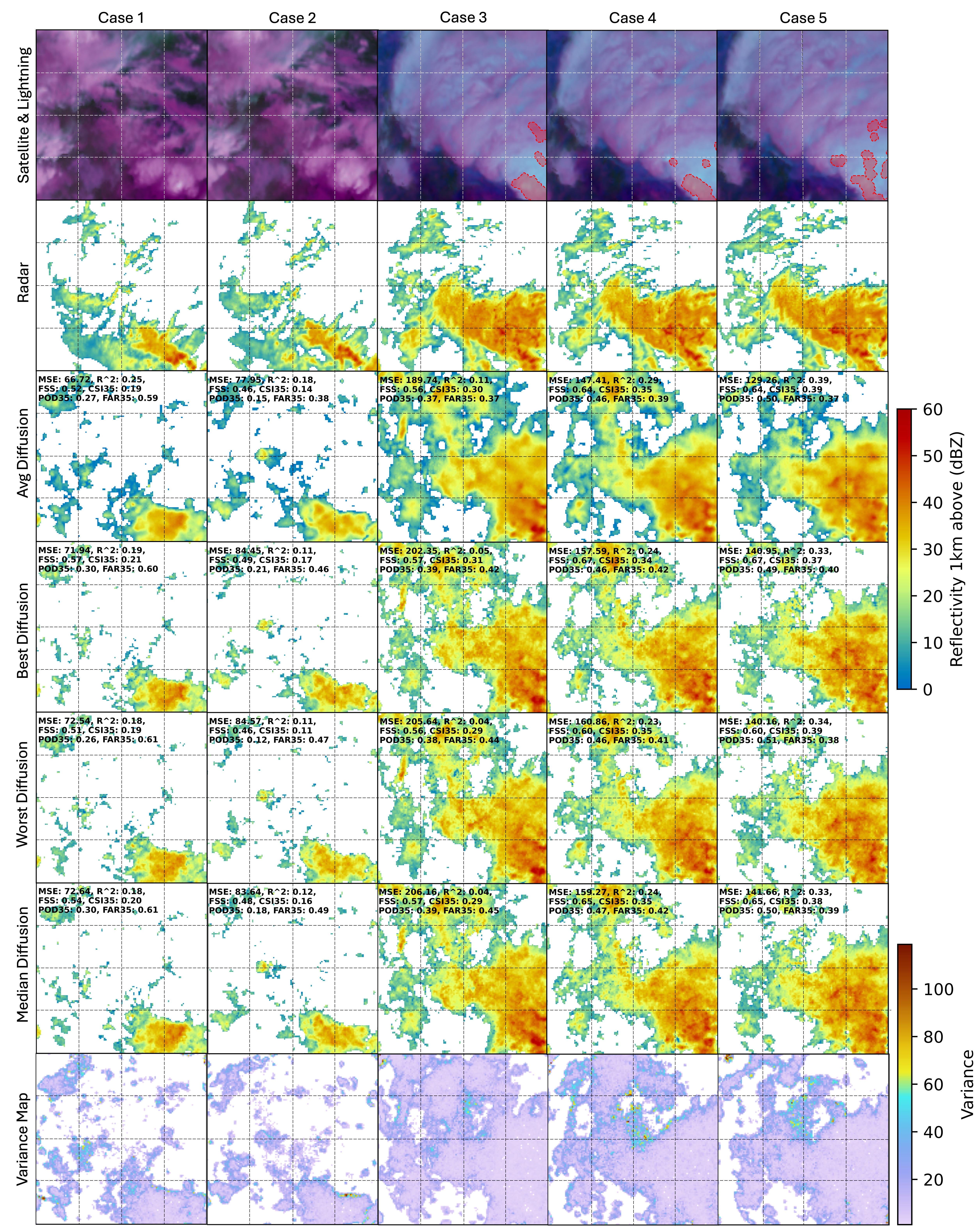
Uncertainty Analysis & Case Studies
Unlike deterministic approaches (e.g., U-Net), diffusion models naturally produce ensembles of plausible radar images. This enables explicit analysis of generation uncertainty and spatial variability under identical satellite and lightning conditions.
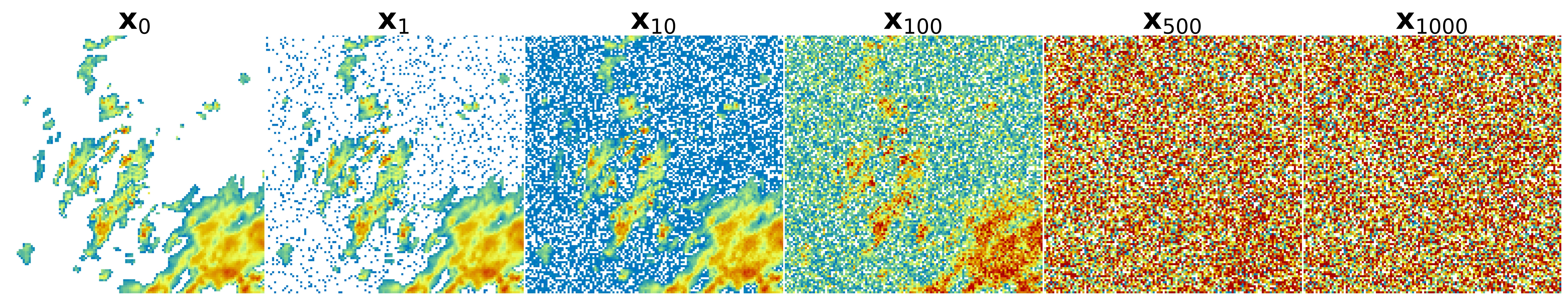
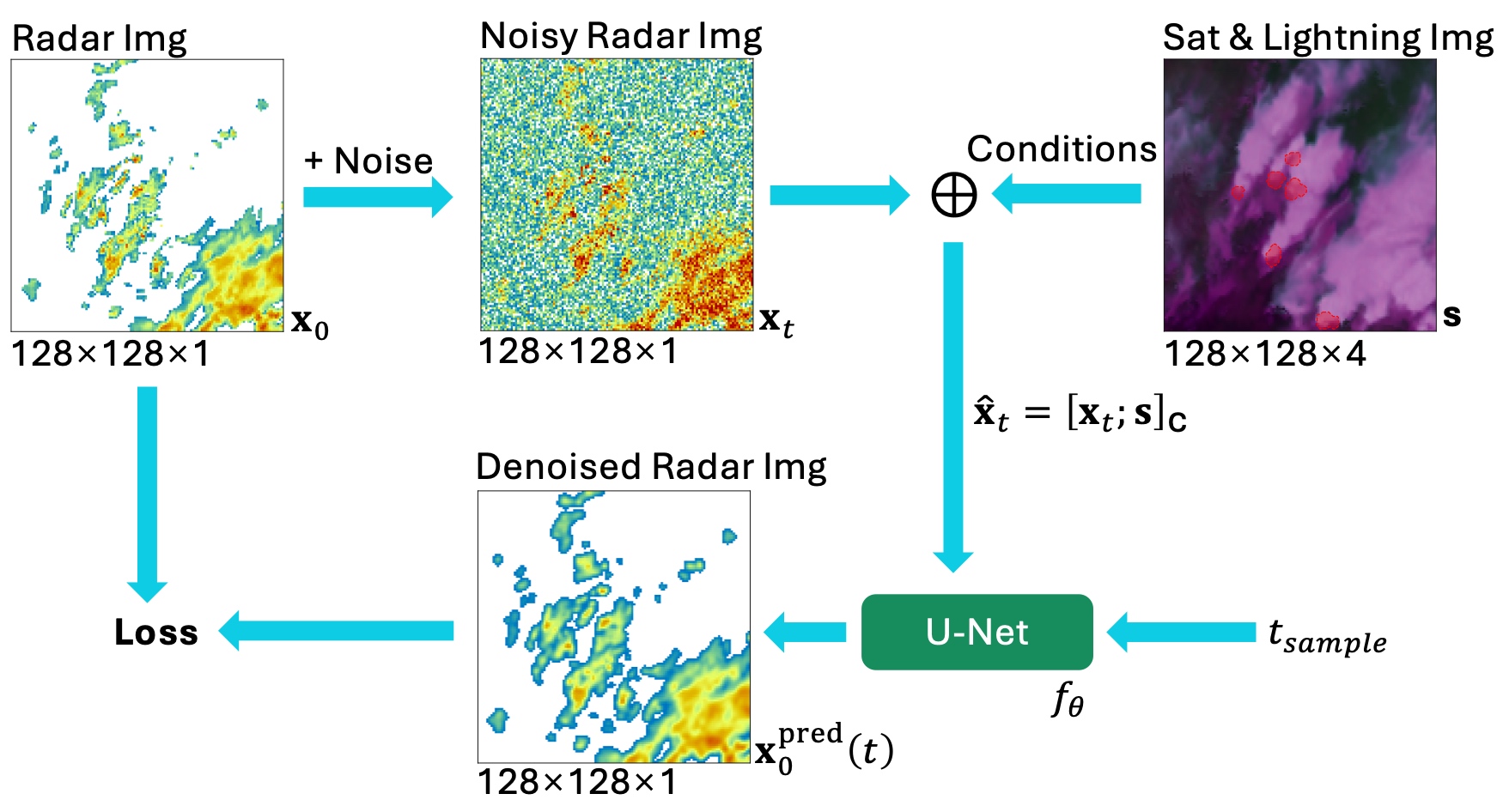
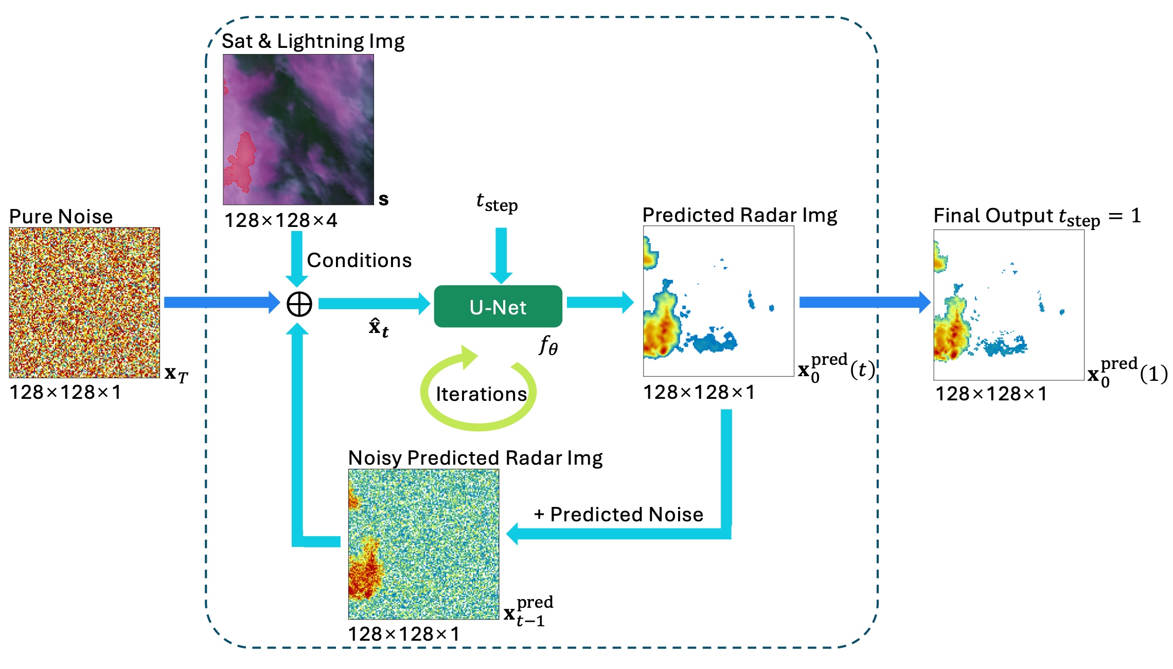
Methodology: Conditional Diffusion Framework
We adopt a conditional diffusion framework, where satellite infrared channels and lightning observations serve as conditioning inputs. A modified U-Net backbone with multi-scale feature extraction and time embeddings is used to predict clean radar reflectivity fields from noisy inputs.
Quantitative Evaluation
We evaluate the generated radar reflectivity images using meteorologically meaningful metrics, including the Fractions Skill Score (FSS) across multiple thresholds and spatial scales, as well as distributional comparisons of reflectivity values.
Poster
BibTeX
@article{Hu2026SyntheticRadarDiffusion,
  title     = {Enhancing Production of Synthetic Radar Images from Geostationary Satellite Observations through Generative Diffusion Models},
  author    = {Hu, Yuguang and Liu, Daochang and Protat, Alain and Louf, Valentin and Brook, Jordan and Xu, Chang},
  journal   = {Artificial Intelligence for the Earth Systems},
  year      = {2026},
  volume    = {5},
  number    = {1},
  pages     = {e250016},
  publisher = {American Meteorological Society},
  address   = {Boston, MA, USA},
  doi       = {10.1175/AIES-D-25-0016.1},
  url       = {https://journals.ametsoc.org/view/journals/aies/5/1/AIES-D-25-0016.1.xml}
}